What's new May 2019

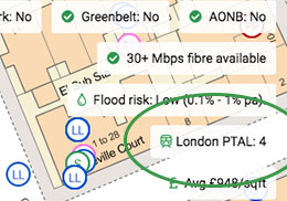
London PTAL scores
We've added London PTAL (Public Transport Accessibility Levels) scores on the Plot Map. For any postcode within Greater London, we'll now show the PTAL score, ranging from 0 (worst) to 6b (best). This is also available via our API.

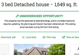
Intelligent opportunity summary
We've been developing an algorithm to describe in plain English the investment opportunity on properties we add to our sourcing lists, in particular on our repossessed and unmodernised property sourcing lists.

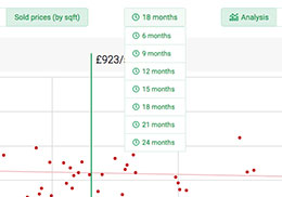
Sold Prices date range
When analysing sold prices in a Local Data search, you can now customise the maximum age of sold prices used. 18 months is used by default, but you can make the window as short as 6 months, or as long as 24 months.

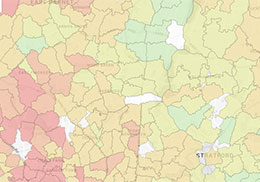
Postcode Map sector-level detail
Our postcode data map now goes down to postcode sector level data granularity (previously just postcode district level). Zoom in to activate the postcode sector level data.
Feature ideas? Questions? Don't hesitate to contact us.
Best wishes,
The PropertyData team


