What's new February 2025
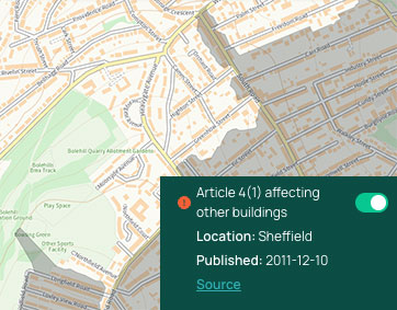
Article 4 restrictions
One of our most-requested features. Launching today, Plot Map now includes nationwide data on Article 4 restrictions.
A yes/no warning label as well as visual outlines on the map is shown for any Article 4 restriction affecting listed buildings, conservation areas or other land (such as HMO restrictions).
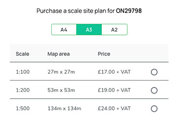
Site Plans in A3/A2
We've seen much more interest in our Site Plans download service than we expected, and by popular demand we have now added A3 and A2 paper sizes to the existing A4 size.
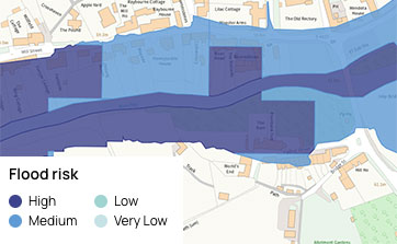
Visual Flood Risk
We've revamped our flood risk data, bringing it up-to-date with the latest 'Flooding from rivers and sea' dataset and now showing it visually on Plot Map with levels of risk, rather than a binary yes/no warning.
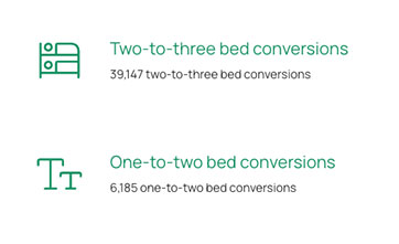
New conversion sourcing strategies
Our on-market sourcing algorithms now include two new strategies, for converting properties by adding an extra bedroom.
This uses our unique floorplan scanning to identify properties that have an excess of square footage for the current number of bedrooms.
Feature ideas? Questions? Don't hesitate to contact us.
Best wishes,
Michael
Founder
PropertyData